Custom Google My Maps: Outdoor dining and drinking establishments – beer gardens in Perth
 For a while now I have wanted to develop something on Google Maps and a couple of weeks ago I came across an interesting post on the “Content Marketing Academy” Facebook group. Someone had created a really useful custom Google Map for “beer gardens in Dundee” and this got me thinking that a similar map for Perth would also be useful, plus it would give me a little project to work on.
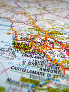
I have always been interested in maps. As a young boy I would pull out the old atlas from the bookcase and spend a long time looking at the colourful maps of places I had been to or places I wished to visit one day. Whether for the better or not, the days when most cars would have a “well thumbed” road atlas under one of the front seats that would be used to plan journeys or help when one became lost are long gone, although I believe you can still buy these paper road atlases today from motoring organisations such as the AA or the RAC.
Road atlases were soon replaced or at least supplemented by programs such as “Microsoft Auto Route” you could use on your computer. These programs were good at giving you directions and planning routes, but weren’t very convenient unless you had a laptop, which at the time in the mid-1990s were quite expensive. Then along came portable and affordables satellite navigation (Sat Nav) devices and now we can download affordable navigation apps for our smartphones.
One of the things I liked about viewing paper atlases or road maps was spotting the various interesting “points of interests” such as picnic places, services stations, cafes, pubs, football stadia, viewpoints etc. Google Maps allow us now to view the wonderful array of “points of interest” in great details and along with its street view functionality, we can now see photo images of such places in great detail.
My previous research on creating custom Google Maps had suggested that I would need to develop something called a “KML file“. Google defines KML (Keyhole Markup Language) “as an XML based file format used to display geographic data in an Earth browser such as Google Earth and Google Maps”.
However, after some further searching online I came across several articles that suggested a facility within Google called My Maps without needing to worry about KML.
After just 30 minutes total development time I was able to create the following custom Google Map with place markers that show the places in Perth where you can experience outdoor drinking and dining – and beer gardens!
If your would like to embed this map on your own website, please using the following HTML code:
Author: Raymond J Moir, Formative Learning
21 July 2015
Free image from http://www.freeimages.com/photographer/vierdrie-46406
